Are local livelihoods and lifestyles on the line? Have your say in the Great Sandy Marine Park Plan
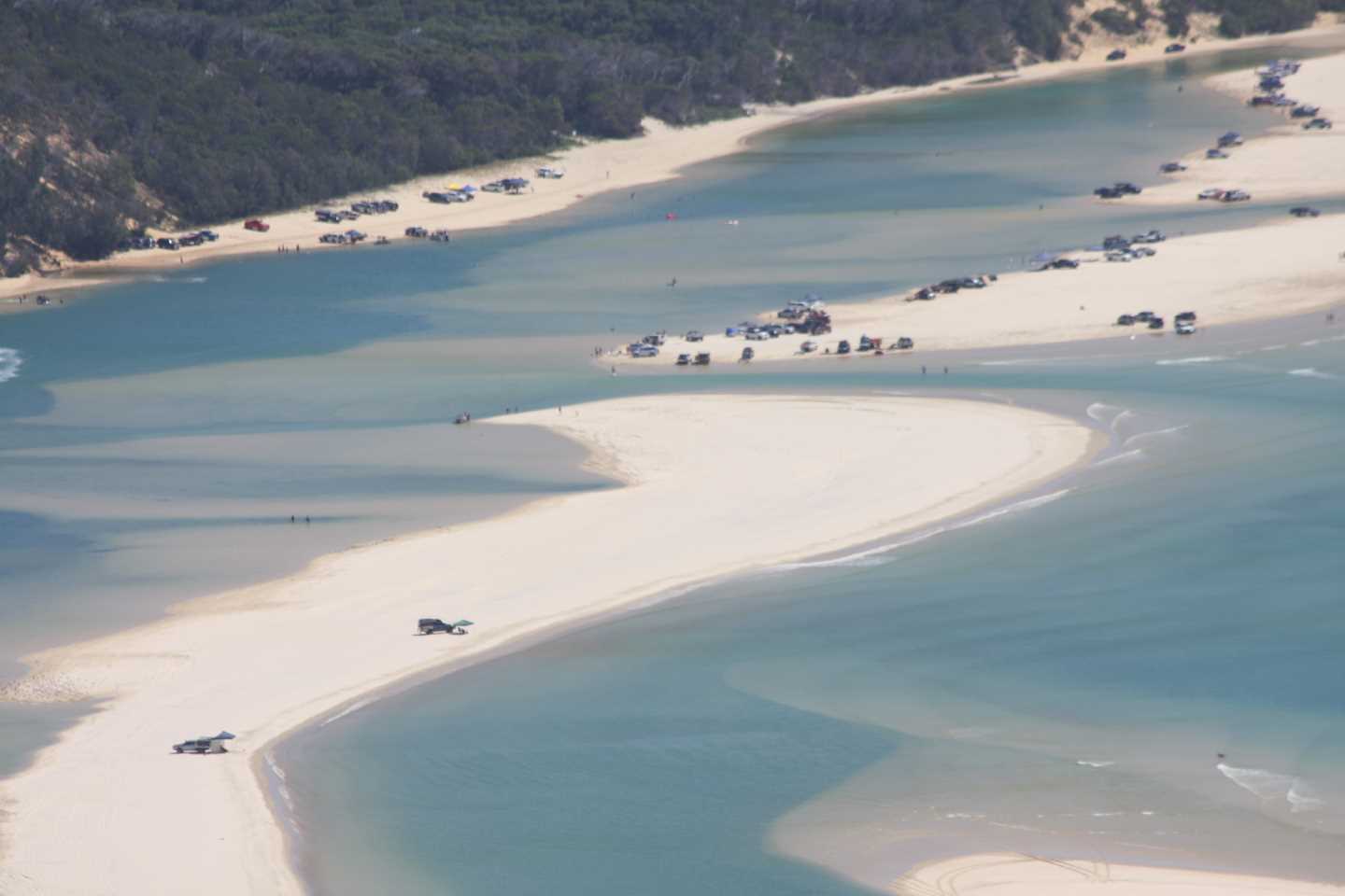
Double Island Point is the southernmost tip of the Great Sandy Marine Park and includes the Great Sandy Straits – make sure you say how to want to help conservation, keep jobs or play in our backyard Image taken whilst on board Rainbow Beach Helicopters
If you like to play in the Sandy Straits or head down to our beautiful Double Island Point, then have your say, so you can continue to do so!
Boaties, fishers and users of the Great Sandy Marine Park are invited to take part in a review of the park’s zoning plan to help guide its future management.
Local MP, Tony Perrett, urges everyone to comment, “It is important that everyone make a submission, no matter how brief, as this type of plan will affect local businesses, tourism, fishing, boating and recreational activities in the region.
“The Minister has advised me that the management framework ‘aims to balance conservation with sustainable use within the Great Sandy Marine Park.’
“I hope that this is not code for closing down legitimate and sensible activities within the region.”
Noosa MP, Sandy Bolton reports on her website that the Great Sandy Straits Management Plan is one of the strategies that will be utilised by the ‘Teewah and Cooloola Working Group’.
At the group based in Noosa, stakeholders discuss impacts, visitation numbers and types, future projections, infrastructure, fees, permits and facilities. Recommendations from the group will be funnelled to various departments and documents.
Although the working group has a representative from Rainbow Beach Commerce and Tourism, Gympie Council and our local MP, the group is top heavy with Noosa locals, bureaucrats and groups, and agendas are not always clear.
Items mentioned for discussion on our regions:
- use of commercial bait nets and whether greater gear restrictions should be implemented
- restricting diving access to the grey nurse shark area at Wolf Rock to marine park permit holders only
- establishing a conservation park zone or buffer zone over The Pinnacles (north east of Wolf Rock) and/or Round Rock
- expanding the conservation park zone at Double Island Point to surround the Wolf Rock marine national park and buffer zones
- extending the existing go-slow area and/or establishing a marine national park zone between Moon Point and Black Creek on K’gari (Fraser Island)
- establishing a marine national park over Turkey Island in its entirety, including any internal channels and inlets, and
- expanding the Kauri Creek go-slow area.
The Great Sandy Marine Park was established in 2006 and protects an area of approximately 6,000km2 along the Bundaberg–Fraser Coast, from Baffle Creek in the north to Double Island Point in the south. It includes Hervey Bay, the Great Sandy Strait and offshore waters to 3 nautical miles.
Acting Environment Minister Craig Crawford said the zoning plan’s aim is to balance conservation, recreation and commercial activities.
“The current zoning plan is now 13 years old and it’s time it had a comprehensive review,” Minister Crawford said.
“The park is important to tourism and for recreational and commercial fishing and it’s a much-loved natural asset for locals, and a popular destination for Australian and international visitors.”
Leeanne Enoch MP Minister for Environment and the Great Barrier Reef, Minister for Science and Minister for the Arts advised that, “Continual improvement of the marine park’s management is increasingly important in the face of a changing climate, increased usage and the community’s desire for better protection of the values that make the Great Sandy Marine Park such an amazing place.”
The report says comments received from the public and stakeholders since the marine park was declared in 2006, suggest that enhancements to its management may be achieved through actions that further:
- support the long-term health and resilience of reef communities
- balance conservation and use within the designated Great Sandy Area
- protect dugongs and turtles from potential boat strike and disturbance in shallow water habitat
- protect critical shorebird feeding, roosting and nesting habitat
- protect nesting turtles, hatchlings and their habitat
- protect the habitat of grey nurse sharks
- recognise the effect of coastal processes in defining zone boundaries around creek mouths • integrate the marine park with adjacent land uses and planning
Responses to the survey and other submissions will be used to prepare a draft revised zoning plan which will be subject to further consultation in 2019.
The discussion paper and background information are available at www.qld.gov.au/marineparks. Provide feedback via the online survey at
www.getinvolved.qld.gov.au. Submissions close February 25.